Building an infrastructure for education is part of the story for any country. The critical components of the education system are the ability to understand the dynamics of the education infrastructure. Key attributes to a building a solid infrastructure is the ability to plan the locations of the schools, the type of schools required, the various facilities that would be made available to the schools and the ability of the geography and the demographics to sustain the school.

However, the above problems can be solved by using a technology solution that helps the administrators to have a bird eye view of a region and build plans accordingly. To enable the same, CSM has developed a GIS based system that can be used to map the development of the educational infrastructure of a region with very specific inputs to make it work. This system makes the planning and monitoring process easy and efficient for the end users.


The School Mapping system is built to ensure the right inputs are made available for the planners to ensure there is a perfect match of students and infrastructure. The system was built to include the all the various essential elements of the planning process. One of the key factors was the inability for planners to have a spatial view of the various educational infrastructure already available in a specific area, including distribution and type of school, ownership, availability of basic infrastructure like power and toilets (including gender segregation) and demographics. This ability to overlay the various data points on a single map is the key to an informed decision-making process.

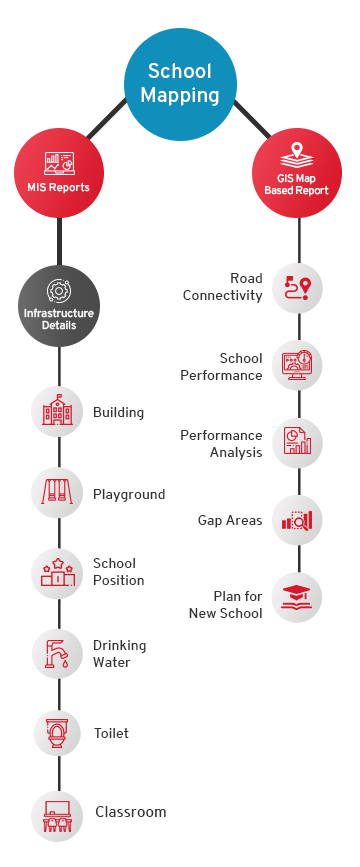
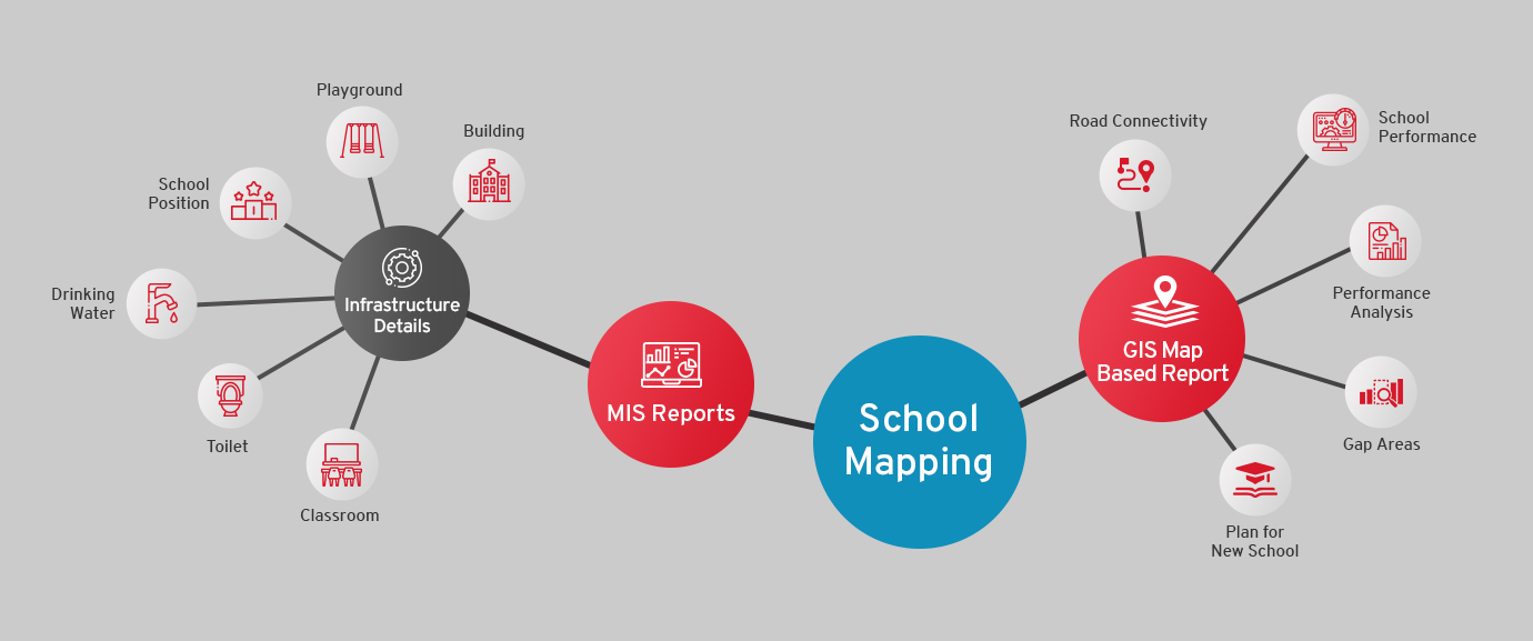
The system consists of two modules:

The plans for an education infrastructure that does not consider the population density, accessibility, socio economic parameters and the availability of resources will not be successful. One of the major reasons why children drop out of schools has been due to their inability to have access.
The GIS Module - CSM Technologies

The GIS Module

The GIS Module helps in identifying the geographical position of any school by calculating the distance between School and other major location with Direction Map. GIS Map based reports are generated for identifying the clusters, road connectivity of the schools, nearest power grids, various grades available for each school, monitoring of school performance, comparative performance analysis trends/ patterns, identification of gap areas and planning of new schools. The system uses various layers to help filter and identify areas of improvement, any specific unmet needs and focus on areas which would need schools in the future.

The MIS Module - CSM Technologies

The MIS Module

The MIS Module is built to provide all the necessary information required to run the school management system. The output of the system is demonstrated as MIS Reports to the management as well as the citizen. It records the school infrastructure details starting from the physical position of the school to building, class, room details, availability of necessary amenities like drinking water, playground, lavatory etc.

GIS Based School Mapping System Flow Diagram - CSM Technologies GIS Based School Mapping System Flow Diagram - CSM Technologies

Subscribe
to our newsletter

Subscribe to have CSM's insights, articles, white papers delivered directly to your inbox. Privacy Policy


Join our exclusive newsletter community on Linkedin